Second Thomas Shoal, Renai, Ayungin, Half Moon Shoal, and Reefs West of Palawan, Philippines, Spratly Islands
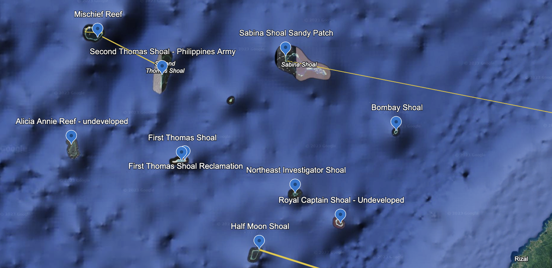
Second Thomas Shoal a.k.a., Ayungin Shoal in Filipino, Rén'ài Jiāo in Chinese and Bãi Cỏ Mây in Vietnamese, per Wikipedia, and is claimed by Philippines, China, Vietnam and Taiwan (ROC) and lies closest to Philippines (approximately 120 miles).
Less than 20 miles from Mischief Reef to the South East, about 110 degrees, this is the formation where the Philippines army has grounded a ship and maintains a presence full-time. This is also where the Navy of China and the Philippines are having somewhat friendly and non-lethal confrontations to cause the Philippines to abandon their post. In recent days around April 2024, we read (in Reuters) that there have been heated discussions and additional water cannon usage, along with blocking of paths around the Second Thomas Shoal.
The Second Thomas Shoal is underwater and undeveloped. However, we have read that there is an ancient warship that was run aground, and we think we may have found it. It isn't very large. Hopefully it has a satellite link and wifi on the ship.
We see a pristine set of reefs, and ships sailing around, and one ship sitting still. Photos from 5/15/2020. Ship location: 9°46'46"N 115°53’24
On October 22, 2023, China accused a Philippine naval ship of trespassing into the area of the Nansha Islands and the Renai Reef, resulting in a collision of ships.

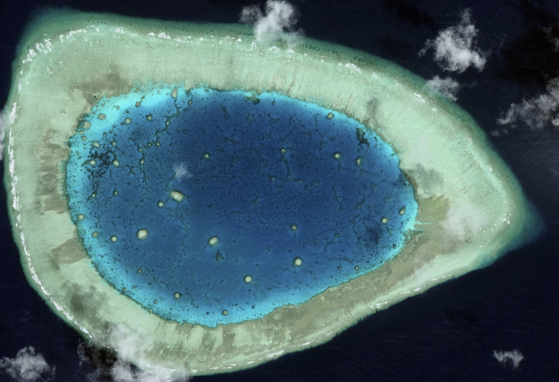
East of Second Thomas Shoal is Boxall Reef which is undeveloped and below sea level. North of Boxall Reef is Hardy Reef, which is also undeveloped and below se, as of 3/11/2018. Level. Moving East between Hardy and Boxall is Sabina Shoal. This is a large pattern of reefs.
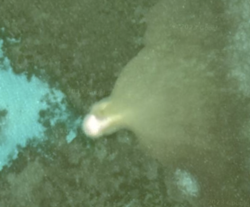
Sabina Shoal has a tiny sandy splotch in the Northwest corner of the large formation. Location: 9°48'53"N 116°21’09”E.
The image is too bright (sorry about that) and was taken 5/17/2018. This sandy reclamation is roughly 123 miles from Quezon in Palawan.
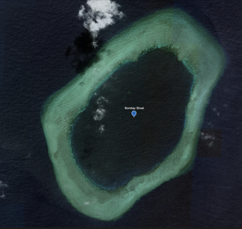
The last formation East of Sabina Shoal is Bombay Shoal, which appears underwater and undeveloped. This satellite image is from May 2017.

After this review, we head down to the area of formations between the Philippines and Indonesia, starting at Rifleman Bank and working our way east through about 15 formations.
The Spratly Islands closest to the Philippines west of the southern third of Palawan island.
Alicia Annie Reef is underwater and undeveloped.
First Thomas Shoal is undeveloped.
Northeast Investigator Shoal is undeveloped, but looks like the edges of the reefs are close to sea level, as we see waves surrounding the island. This is fully enclosed. Location: 9°10'18"N 116°28’00”E.
Eastward we see Royal Captain Shoal which is fully submerged and undeveloped.
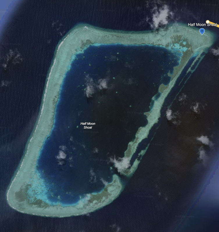
Half Moon Shoal, location: 8°55'33"N 116°17’15”E, is a place to watch. New development. These satellite images are from June 11, 2019. Future airport potential here. Only 70 miles from Palawan Island in the Philippines. The current satellite Photos are from 12/14/2015, and are eight years old.
Thanks to the straight line down the Eastern side, this would likely make a great airport, with a pre-made entry into the protected waters to the Southeast (likely where the airport would stop at the Southern end).
Name 1
Nearest Land
Distance from Land (miles)
Location (latitude & longitude)
Diameter (miles)
Date of Satellite Imagery
Airport Present?
Helipad Present?
Port / Dock Facility Present?
Buildings Present?
Defensive Infrastructure Present?
Athletic Facilities Present?
Hospital Present?
Sand Only Island?
Dredging Infrastructure Only?
Spratly Islands
Half Moon Shoal
Philippines
70
8°54'16"N 116°15'18"E
4.0
12/14/2015
No
No
No
No
No
No
No
No
Yes
Consulting Session
This is a one-hour meeting, remote or in-person, with Jeffrey Cohen, President of U.S. Advanced Computing Infrastructure, Inc.
You choose the topic and deliverables.
You may buy multiple hours to fund a project.
We believe management consulting is pursuing "the art of the possible." These are areas where we believe we may be helpful:
- We will discuss our research into the South China Sea
- We offer traditional IT management consulting services.
- We offer quantum computing consulting
- We offer financial investment analysis of stock portfolios based on our Chicago Quantum Net Score (read more in our published research). Today we run a model that analyzes ~3,000 U.S. listed equities and optimizes both 'long' and 'short' stock portfolios.
- Project and program management.
- Outsourcing advisory.
- We run your business problem on our discrete mathematical models (on our own server equipment using our own solvers).
- We may configure and run your problem on quantum annealing computers from D-Wave Systems Inc.
- We ALWAYS work confidentially, diligently, free of conflict of interest, and bring our best thinking and insights.
We can operate at both the strategic and tactical level depending on client need. This includes business strategy, business problem decomposition, mathematical and data design, algorithm design, and use of quantum and classical solvers. The President has a strategic perspective from ~ 30 years of executive corporate management in IT and professional services, and also rolls up his sleeves and codes when there is a good fit with the problem and his expertise.
Absolute discretion and professionalism is assured.
In closing
If you would prefer to discuss this 1:1 and negotiate a scope of work and level of effort, please contact us at jeffrey@quantum-usaci.com or call (312) 515-7333. We will develop a quotation and will invoice for our services.